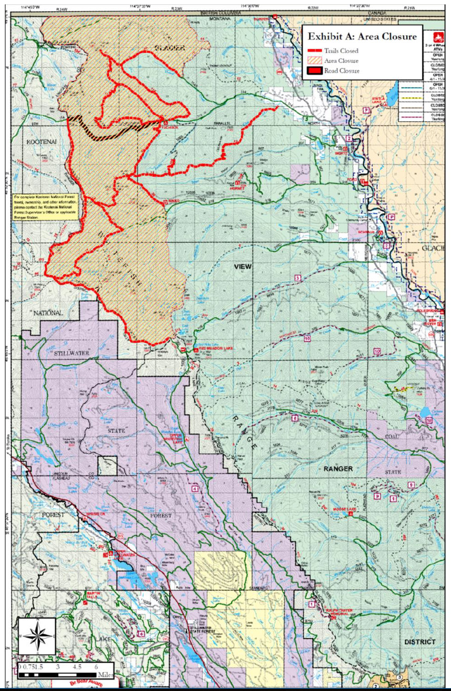
Gibraltar-Weasel Closure Map, Sep 10, 2017
This just in from the Flathead National Forest . . .
Media Contact: Janette Turk
(406) 758-5252
jturk@fs.fed.us
Kalispell, MT. September 10, 2017- The Gibralter Ridge Fire and the Weasel fire are burning in the Kootenai National Forest approximately 7 miles east of Eureka. The east side of the Gibraltar fire has moved into the mouth of the Blue Sky drainage in the Whitefish Range. The Weasel fire has moved near the Flathead and Kootenai forest boundary. To protect health and public safety by keeping the public out of the active fire area, the Kootenai National Forest has closed a large area from the Whitefish divide to the west boundary of the Fortine District, and from the Canadian Border to Deep Creek. The Flathead National Forest has closed an area north of Link lake trailhead north to the Canada border and east of the Kootenai border.
The following NFS Road is partially closed:
- A portion of NFS Road #114 (Trail Creek Road) from the Flathead National Forest boundary to the junction with Stoken Bridge/Foothills Road. To support these efforts the Flathead National Forest has installed a gate on NFS Road #114 (Trail Creek) and has closed NFS Road #114 from mile point 8.8 to 14.8, the boundary with the Kootenai National Forest.
The following NFS trails are closed:
- Trails 19, 23, 114, 113, 22, 13, 28, 79, 11, 13, 106 and 26 from the Link lake TH to the north.
The following NFS area is closed:
- Area from the Link lake TH north along the Kootenai/Flathead NF boundary to the Canada border
Forest fire fighting resources are supporting the fires listed above and are prepared with initial attack resources as needed. For more information contact the Hungry Horse/Glacier View District at 406-387-3800.