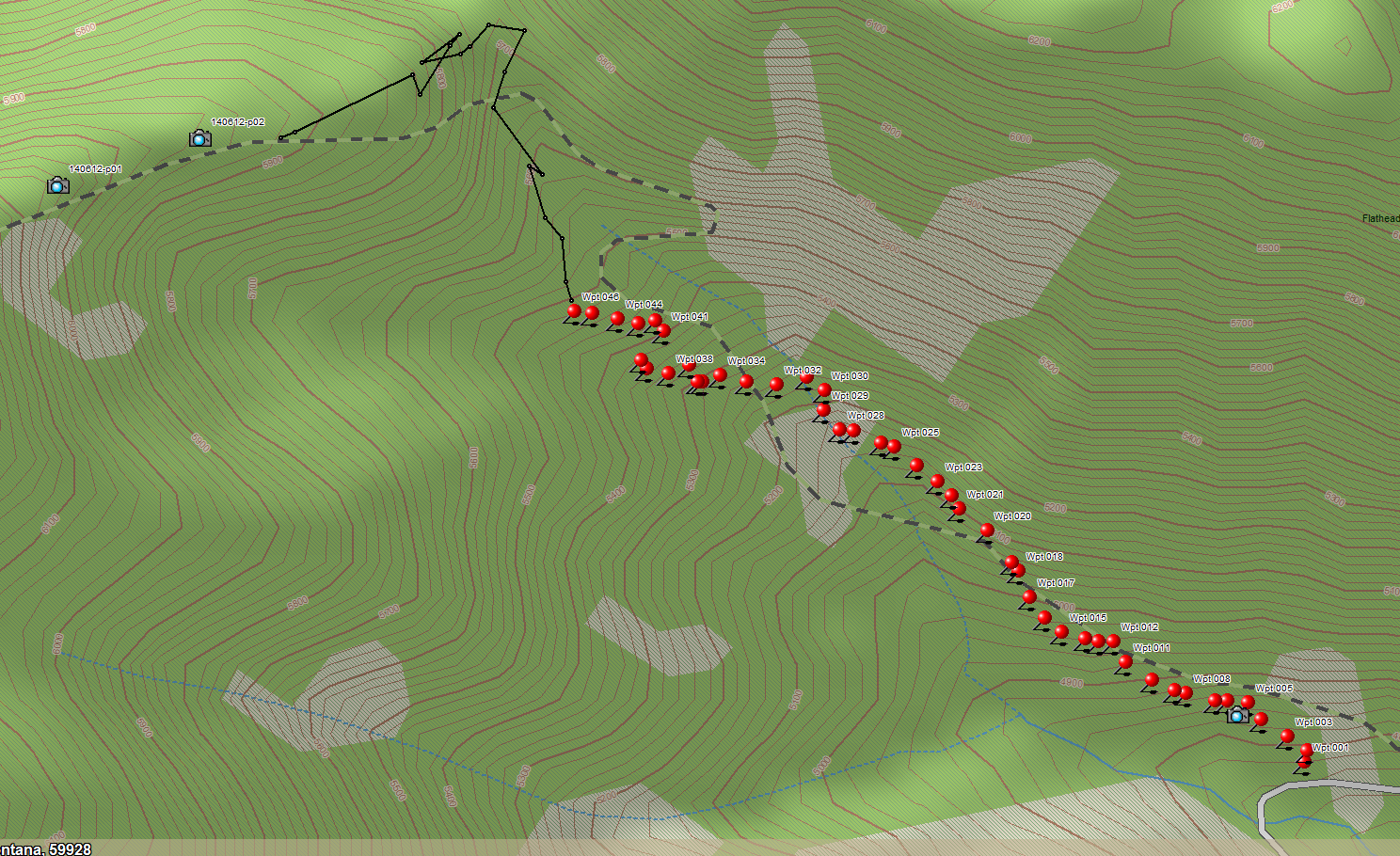
John Frederick and I took a run up Trail 4 yesterday, June 24, with the objective of acquiring a good set of waypoints for the final segment climbing up to the ridge top. See below for the result.
Barring the usual handful of outliers, we now have an accurate set of coordinates running from Road 909 to the top of the ridge. This completes the important stuff. The remainder of the trail just stays on top of the ridge — no mystery there.
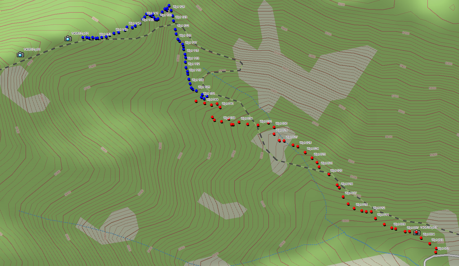
The red dots are data acquired in September of last year. The blue ones represent yesterday’s effort.
Trail 4 Waypoints from Road 909 to Ridge Top